Saturday, June 30, 2012

Indian Country

This has been a long hard ride, but I wanted to get to the Black Hills so I can have tomorrow as a relaxed day. Much of the day I spent riding through the rolling hills, occasionally interspersed with bigger mountains, that were the last lands defended by the Plains Native American Tribes.


These lands once had grass so tall it could hide a rider on horseback, tens of thousands of buffalo roamed them at will, and they had been given to the tribes in perpetuity. 


I rode past place names such as Crazy Woman Creek, Piney Creek, Powder River, and of course Little Big Horn. It was there that one of the noblest of the Chiefs, Crazy Horse, made his grandest and most tragic gesture of resistance at the greatest battle of the Plains.

Suddenly and without provocation a huge gathering of tribes was attacked by the legendary 7th Cavalry. Crazy Horse gathered the braves and rode to meet the aggressors. As he charged into combat he urged on his compatriots with the words: "It is a good day to die." He didn't. In a strange way it might have been  better if he had. Instead the arrogant, foolish, and ignorant George Custer lead his soldiers into a devastating disaster, which destroyed any chance that the United States would ever treat the Indians with the slightest decency. Crazy Horse died sometime later, in government custody, betrayed by his own people and the officials who had promised to protect him.

Of all the lands taken away from the tribes, none were more galling than the Black Hills which had been promised to them "forever." To add insult to injury the faces of four white men who cared or understood little of the meaning of all this, in fact one of them was a major contributor to the tragedy, were carved into the fabled hills.

A Polish artist,  Korczak Ziolkowski moved as I am by the events wanted to do something to balance the record. He acquired land and entirely on his own started a memorial to Crazy Horse. It is to be the largest statue in the world, dwarfing Mt. Rushmore. Crazy Horse will be depicted on his pony, pointing to the Black Hills as though to say: "They will always belong to the Great Spirit, always free!" Ziolkowski  has since died but his family continues the work. I saw it thirty years ago. Now I want to see the progress.

For me, Crazy Horse's sad tale need not be his legacy. Instead he can always be on his pony, with the charging braves around him. And I will know, it was indeed "a good day to die." For John Donne wrote: "Death you shall die."

Friday, June 29, 2012

Back in the Saddle Again

I left Sandpoint this morning in a bit of a drizzle. It soon cleared up.

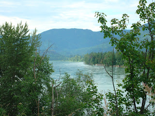
Here is a parting picture of the Sandpoint area.


I was traveling down State Route 200 and fairly soon entered Montana. Once again the landscape cannot be described in words.

A few views of the country I was riding through.


I am now in Livingston, Montana. I am at the North Entrance to Yellowstone National Park, so the obvious question is am I going in. No. Really. I have been to Yellowstone twice and on this trip I have another objective, the Crazy Horse Memorial in the Black Hills. More on that tomorrow.

I am at a Great Western Motel in Livingston and what a class act. As I checked in as a motorcyclist, I was given a gift of bottled water and cleaning supplies for my bike. The bike is also parked in the VIP garage, out of the sun. Now that is how to treat Moto riders.

View from the Motel.


The town is pretty cool too.


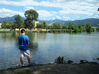
Here is the city park, just like the rest of the country.


Tomorrow I will ride to Rapid City, just above the Black Hills, and I plan to stay two nights so as to have time at the memorial. 

One has to live it to believe it.
 

Wednesday, June 27, 2012

Starting Home

It looks as though the weather is cooperating nicely, so I will be starting out Friday morning. I will be bound for Rapid City, South Dakota. It is a two day ride. Stay tuned.

Tuesday, June 26, 2012

Pickles and Motorsickles


Remember this picture of the road out of Lewiston. 


It reminded me of Arlo Guthrie's famous song.


Monday, June 25, 2012

Pictures of Sandpoint

 I thought I would include this link to pictures of the Sandpoint area. It is truly a beautiful place, though it does have harsh winters. At this time of year it is quite idyllic.

Saturday, June 23, 2012

La Verne, CA to Sandpoint, ID Stats

Here are some numbers for the north bound trip.

Total Miles, including getting lost, going from a motel to get food, etc: 1265(2035 km)
Total travel time including all stops for food, touring, gas etc: 24.5hrs. Average speed 51.6 mph (83 kph)

Gas mileage: 47.8  mpg (20.3 km pl)
Highest price per gallon: $4.29(McDermitt, NV).  Lowest price: $3.60(Sandpoint, ID). Average price: $3.95 (.83 euro pl)

Lowest price motel in Hawthorne, Nevada $60 and highest in Lewiston, Idaho $100.

Friday, June 22, 2012

In Sandpoint

I am safely at Steve and Molly's house, after a three hour ride from Lewiston. Nothing to distinguish the day. I did want to add a few pictures of Lewiston taken as I left, showing the road and Lewiston from the top of the pass out of there.

How is this for a motorcycle road?

One more from the road.
I will be here for about a week. From now on the trips will in a homeward direction. I will post plans as I develop them.

Thursday, June 21, 2012

I Rode a Dream Today

Today was the kind of day that you think might be possible, but really only happens on travelogues that have been artificially created. US 95 from north of Boise to Lewiston has to be one of the most beautiful roads in the United States. Additionally, it is glorious motorcycling on smooth, wide sweeping curves where every new vista is more magnificent than the previous one. Words fail, so let the land speak for itself.


America the Beautiful.

"This land is your land; this land is my land... this land was made for you and me!"


I have a very short ride for tomorrow, so I won't have to rush in the morning and should be with Molly and Steve by early afternoon at the latest. 


Wednesday, June 20, 2012

So why am I just outside of Boise, Idaho?

I am in Caldwell, Idaho, just a bit north of Boise. I'll get to how I got here, but first a few parting comments about northern Nevada; it is quite beautiful. 

I left Hawthorne in the morning feeling reasonably well.  As soon as I got a few miles I realized what distinguishes this area. There is a huge lake, Walker Lake, to the North. That helped explain the sign I saw as I entered town from the South, Naval Underwater Training Station. Underwater training in the middle of Nevada? Now it made sense. Who would think Navy Seals train in Hawthorne, Nevada?

The lake is huge and very scenic.

Once I left the area, I continued to enjoy the dramatic vistas.


My target was a little town on the Oregon border, McDermitt. It was supposed to have a couple of okay motels. Well, when I got there the motels looked pretty shabby, so I decided to go to Jordan Valley, which was advertising heavily on the road, Jim's truck stop and motel. There also were supposed to be a couple of B & B's. It was a hundred miles up the road and it was only 1:30. Big mistake. The B & B's were closed and Jim's motel made the McDermitt motels look like the Bellagio in Vegas. So what to do? Not much choice; push on towards Boise, another eighty-five miles. As soon as I reached I84, I turned North to the first intersection with hotels and found a very nice La Quinta Inn for eighty bucks. I had lost an hour to go onto mountain time, so it was already six, long day. Oregon was not as pretty as I had expected, but southwestern Idaho was lovely. I did not stop for pictures as I was riding hard.

There is a good side to all this. I have less than five-hundred miles to go and can take two very light days to get there. I am going to stay off the interstate and go through the mountains.


I will see where I get to, and try to take many pictures.

Tuesday, June 19, 2012

Hawthorne, Nevada

Well I am in Hawthorne. After all the nasty innuendos it is not so bad.  The temperature is in the upper 80's and quite comfortable; the El Capitan Casino and Motel is plain but clean and perfectly adequate. So I am good.

I do have a cold, but I didn't want to abort the trip and it has so far not been a problem. I am a bit uncomfortable, but it is okay. The ride here had some bad stuff and some great stuff. 

I waved goodbye to Southern California at the Cajon Summit. I had this strange feeling that it could be the last time I leave that way in a vehicle. What strange thoughts sometimes pass through our minds. The next part of the ride was the pits. First of all the area is developed for miles, full of strip malls, fast food joints, endless grotesque housing developments, each trying to be something unique, achieving instead  to be simply banal,  and stop and go suburban traffic, with a thousand trucks and RV's added. When that started to clear up a bit, the wind started. For the next hour or more, all the way to China Lake, I was thrown around on the road. It was very tiring. Finally, at China Lake, as the magnificent wall of the Sierra loomed up in front of me and the road turned to parallel the mountains everything settled down and the ride became glorious.

The Owens Valley is even a bit greener than it was.  I guess they have managed to get some of the water that Los Angeles started to steal in the 1920's (Remember the film Chinatown) to stay in the valley. The iconic view of the mountains along this route is Mt. Whitney from Lone Pine.


There is very little snow. The light color is just the light granite.
I stayed on US395 until Bishop. From Bishop I turned a bit East along US6 to US95. I expected the ride to be hot and boring, not so. The ride was cool and the scenery, though forbidding and arid, was quite impressive. So I am here. Tomorrow I expect to get to somewhere in eastern Oregon.

Monday, June 18, 2012

Tomorrow looks to be go. I'll publish when I get settled in for evening, wherever that is. I am aiming for Hawthorne, Nevada. No I am not kidding. I have never been there, probably for good reason.

Here is a link to town propaganda.

Saturday, June 16, 2012

Plans

My plans are beginning to firm up. I have a couple of visits to complete tomorrow and Monday. Then, I plan to leave Tuesday. I expect to take four days to reach Idaho. That way I will not have push too hard. I do expect to ride with determination and not spend a lot of time touring, but much of the route will be completely new to me, so I don't know exactly what to expect. Here is a link to the route I am planning.


Wednesday, June 13, 2012

Next Destination

These words of Lord Tennyson seem to have some meaning here.

Though much is taken, much abides; and though
We are not now that strength which in old days
Moved earth and heaven, that which we are, we are---
One equal temper of heroic hearts,
Made weak by time and fate, but strong in will
To strive, to seek, to find, and not to yield.

A weather window seems to be opening up during the first part of next week that will allow me to travel north to Idaho, my next destination. I will post when I have definite plans.

Sunday, June 10, 2012

Virginia to California Stats

Here are some numbers for the west bound trip.

Total Miles, including getting lost, going from a motel to get food, etc: 2960(4763 km)
Total travel time including all stops for food, touring, gas etc: 62hrs. Average speed 47.7 mph (76.7 kph)

Gas mileage: 47.1 mpg (20.02 km pl)
Highest price per gallon(Needles, CA): $4.99.    Lowest price( Missouri): $3.29.    Average price: $3.72 (.78 euro pl)

Lowest price motel in Athens, Ohio $40 and highest in Dodge City, Kansas $140.

Primary Objective Accomplished

Well, I did it. I crossed the United States on a motorcycle. It took fifty years from when I first planned it, but it is done, not bad for a man of 72. But then one is only as old as one thinks one is, and I am not going to quit being alive.

As I was traveling across the desert this view seemed to show the "road that seems to try to reach the sky."


I stopped at the Summit Inn at the opening of the Cajon Pass. Cajon Pass crosses the San Gabriel and San Bernandino Mountains that separate the California high desert from the valleys that form Southern California. Since the building of Route 66 in the thirties, first the dust bowl Okies, then the migrations of the forties and fifties streamed through this pass searching for the garden of Eden, the Promised Land. It is the Gateway to Southern California. In 1952 The Summit Inn opened as a motel, restaurant, and gas station right as the road started down into the valleys. Today only the restaurant, beautifully restored in the classic fifties diner style, remains; but for those who have a connection with the history of Southern California it is a symbol of everything this region represented during the second half of the Twentieth Century. I stopped to have a Root Beer Float.


So I am at Toni and Margie's in La Verne. I plan to decompress for a few days, and then I can arrange to see everyone I want to see in Southern California and start to plan what next. My intention is to go to Idaho and back through Kansas. So I will see. For right now I am ready for a rest.

Brothers

Much love to all who encouraged me, and helped me on my way.


Friday, June 8, 2012

Spike's Home Town


I am in California, just. It is 112 degrees outside of the motel. The bike handles the heat well. I plan to leave for La Verne at six in the morning to avoid the heat in the desert. I should get to Barstow before it gets too hot.

I started the day in old Flagstaff on route 66. My Motel was on 66.
Old Historic Flagstaff.
The Old Railway Station

This one is for Randy
I started the day by riding out to the Grand Canyon.


I returned to Route 66 in Williams and stayed on a off it for much of the day. Right now I am in Rio Del Sol Motel on 66 in Needles.
Some iconic scenes from the America's Mother Road.
Delgadillo's in Seligman is where I had lunch. One of the best burgers in the US.
This has been a sweet and sad day. The first time I was on 66 was in 1957 when I came out to California with my brother, just after I graduated high school. The second time was when I drove the whole road from LA to Chicago with some UCLA students going East. From Chicago I went by bus to visit home in NYC. The most important time was on my honeymoon in 1964. We were on our way to visit my mother and brother in NYC, by way of Chicago. I can't count how many times I have been on 66 or I 40 since then. The last was my last road trip with Pauline, when we retraced every surviving bit of the grand old highway from Joplin to LA . That was three years ago. Today I didn't complete a mile of the road without tears streaming down my face.
Route 66
 
My dear Pauline
I see your smile on every curve
I hear your voice in each cafe
I feel your warmth with every motel stay
I know your joy at each discovery
This road
We knew its every single mile
And that is why I can't believe
I've said goodbye.

So there I was on my honeymoon road, the honeymoon for which I sold that motorbike so many years ago. 


Thursday, June 7, 2012

Greetings from Flagstaff.

New Mexico to Arizona on I 40.


Straight forward easy ride today. When I started out from Santa Fe I was bit worried about my bikes performance. My gas mileage on one of the legs over Raton pass was 39 mpg. I had never seen a number like that. But today mileage was over 50 mpg! Yesterday I rode really hard, 75-80 mph against strong headwinds. Today I took it easy at 70 mph and had little wind. I guess a bike reacts to conditions more than a car. I love getting comments so please do post them; it makes me feel connected to all my friends.

Tomorrow I will have an easy day. I'll do some genuine sightseeing. By evening I will stop in Needles, and leave there at 7 in the morning to get over the desert well before noon.

Wednesday, June 6, 2012

I'm not in Kansas any more.

Remember when I said that I would not make Santa Fe. Well, I am in Santa Fe, 522(839 km) miles today! And I am less tired than I was yesterday.

The first part of the ride was through Western Kansas and Eastern Colorado. At one point I rode for forty-five minutes at seventy miles an hour without seeing a single structure, car, or anything.

This is what it looked like from my point of view.

However once I reached Trinidad, Colorado everything changed. I was now on an Interstate winding through Raton Pass. I had to completely change my whole style of riding. I made excellent time on beautiful high speed turns that glided through an ever changing topography. Once in Santa Fe I am in the South West. From here I will be in my own stopping grounds. I know the rest of the way in detail. I can't even count how many times I have driven Route 66 and I40 over the years. Here is the rest of the route to California.


I won't guess where I will be tomorrow.


Tuesday, June 5, 2012

Back on the Road.

While in Lawrence the bike was serviced by Tim Wolfe at Motorcare in Lawrence. He found a problem with the steering and corrected it. It is great to find someone who has experience with Honda's, and understands a PC800. My bike will be much the better because of his expertise.

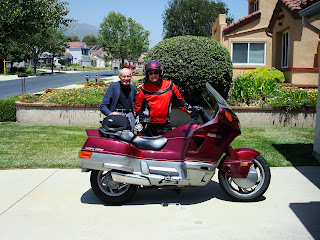
Well, this morning I left Lawrence heading west, to the Wild West that is, Dodge City. Randy e-mailed these pics of me leaving.


I made swift work of the trip, arriving in Dodge by 1 p.m. I had a reservation so getting a hotel was not an issue. The town still looks dead late in the afternoon, but there isn't a room to be had. Kansas is quite a sight as one travels from small town to small town. The road just goes West.


I have had a chance to go into town, and look at the obligatory Boot Hill tourist trap, a reconstruction of Dodge City when Wyatt Earp was sheriff and the most famous gun fight in western lore took place. Actually it wasn't that much of a gun fight, but the legend is huge. Here are a few pics of the old town and of Wyatt himself.


The modern town looks like this.


Tomorrow I set out towards Santa Fe and Albuquerque. I'll see were I get to.